- Acronym Guide
- AAM
- ABS
- AC
- ACAS
- ADS-B
- AEHF
- AFAC
- AGL
- AI
- AIM
- ALPA
- ALS
- AM
- AMA
- ANSP
- AOI
- APPI
- AUV
- AUVSI
- ARPAS-UK
- ASTM
- ATC
- ATO
- BLOS
- BVLOS
- CAA
- CAAC
- CAB
- CAP
- CASA
- CATT
- CBO
- CBR
- CBRN
- CDMA
- CDR
- CFI
- CFR
- CIR
- COA
- COMINT
- CORS
- COTP
- COTR
- CPTED
- CV
- C2
- DAA
- DAS
- DEM
- DFI
- DFS
- DGCA
- DHS
- DOD
- DPA
- DPEs
- DRG
- DRO
- DSM
- DSMX
- DSP
- DSSS
- DTM
- EASA
- EFT
- EO
- EOD
- EO/IR
- ELINT
- EMI
- ESC
- EVLOS
- eVTOLs
- FAA
- FCC
- FCS
- FHSS
- FICCI
- FLIR
- FOB
- FOV
- FPS
- FPV
- GBDAA
- GCP
- GCS
- GDPR
- GML
- GNSS
- GPS
- GSD
- GVC
- HDR
- HOGE
- IACRA
- ICAO
- ICS
- IMU
- INS
- IR
- ISA
- ISR
- ITU
- JARUS
- LAAMS
- LAANC
- LAATM
- LAI
- LAS
- LBA
- LIDAR
- LOS
- LSALT
- MAC
- MAVLink
- MLIT
- MMS
- MSL
- MTOM
- NDAA
- NCSL
- NFZ
- NIST
- NMEA
- NOTAM
- NPA
- NPRM
- NTIA
- OBIA
- OEM
- OFDM
- OGI
- OOP
- PAS
- PASM
- PAV
- PCV
- PdM
- PEC
- PIC
- PID
- PIPL
- PLD
- PM
- PN
- PPK
- PPS
- PSM
- PTZ
- PWM
- UAM
- UAOP
- UAS
- UASTM
- UAV
- UCAVs
- UHD
- UHF
- USV
- UTM
- RAIM
- RCC
- RCS
- RFI
- ReOC
- RePL
- RMS
- ROI
- RPAS
- RPC
- RTH
- RTN
- RTK
- SaR
- SAR
- SARP
- SBAS
- S.Bus
- SBIR
- SEDENA
- SfM
- SFOC
- SIGINT
- SLAM
- SMS
- SOP
- SORA
- STANAG
- STTR
- STK
- sUAS
- TCAS
- TCCA
- TFR
- TIN
- TLM
- TOF
- TP
- TPS
- TSA
- VHF
- VLOS
- VTOL
Drone Acronyms
What is CV (Computer Vision) & How Does it Work?
By
Jacob StonerTable Of Contents

Definition
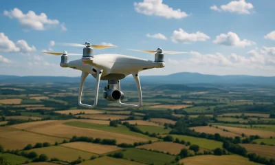
CV, or Computer Vision, is a field of artificial intelligence that enables machines to interpret and understand visual information from the world. In the context of drones, computer vision refers to the use of algorithms and image-processing techniques that allow drones to identify, classify, and analyze objects, patterns, and environments from visual data captured during flight.
Usage
Computer Vision is used in drone operations for a variety of tasks, including automated inspections, obstacle detection, object tracking, terrain mapping, and precision navigation. In AI-powered inspections, CV enables drones to autonomously detect defects in infrastructure, measure dimensions, and even monitor changes over time—all without human input during the flight.
Relevance to the Industry
Computer Vision is transforming how drones are used in industries such as construction, energy, agriculture, public safety, and environmental monitoring. It replaces manual inspection processes with real-time, high-accuracy automated evaluations. CV also plays a central role in enabling fully autonomous drones by providing the “eyes” they need to interact with their surroundings intelligently.
How Does CV (Computer Vision) Work?
Computer Vision in drones works by combining camera data with advanced algorithms that mimic human visual understanding—allowing drones to “see,” interpret, and respond to their environment autonomously. Here’s how the process works step-by-step:
Visual Data Acquisition
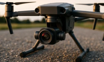
Drones are equipped with high-resolution RGB cameras, infrared cameras, or multispectral sensors. During flight, these cameras continuously capture video streams or still images of the surrounding area, which serve as the primary input for CV systems.Preprocessing of Imagery
The raw images are cleaned, corrected for distortion, and sometimes enhanced for contrast or focus. This step ensures consistency across frames and improves the accuracy of analysis.Object Detection and Classification
Using trained AI models—typically convolutional neural networks (CNNs)—the CV system identifies features of interest within the images. This could include cracks in walls, missing bolts, plant stress indicators, or even people. The system not only detects objects but can also classify them into categories (e.g., corrosion vs. rust).Spatial Awareness and Tracking
CV systems apply geometric models to estimate depth, position, and size of the detected objects relative to the drone. This enables functions like tracking a moving object or navigating through tight spaces using real-time feedback.Analysis and Decision-Making
Based on visual interpretations, the system can take automated actions such as:Marking and flagging defects
Adjusting flight paths to get better inspection angles
Triggering alerts or logging GPS-tagged evidence for post-flight analysis
Data Integration and Reporting
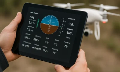
The processed visual data, often combined with telemetry, is stored or transmitted to cloud platforms for real-time insights or post-mission reports. In inspection workflows, annotated images and issue classifications help speed up decision-making and maintenance planning.
Computer Vision essentially gives drones the power to inspect, analyze, and react without constant operator input—making operations more autonomous, efficient, and intelligent.
Example in Use
“Equipped with computer vision, the inspection drone automatically identified and flagged corrosion on the transmission tower during its flight path.”
Frequently Asked Questions about CV (Computer Vision)
How does Computer Vision work in drones?
Answer:
Drones capture images or video through onboard cameras.
CV algorithms process this visual data using models trained to detect specific features or anomalies (e.g., cracks, heat signatures, or crop stress).
The system then interprets the data, assigning meaning and triggering responses such as alerts, image tagging, or navigation decisions.
What are common applications of CV in drone inspections?
Answer:
Infrastructure Inspection: Identifying damage on power lines, bridges, towers, and buildings.
Agricultural Monitoring: Detecting plant health issues, irrigation leaks, or weed infestations.
Search and Rescue: Locating people using visual cues or thermal overlays.
Construction: Verifying progress by comparing real-time images with 3D models or blueprints.
What are the benefits of using Computer Vision in drone operations?
Answer:
Automation: Reduces human effort and speeds up inspections.
Accuracy: Detects issues that may be overlooked during manual reviews.
Scalability: Allows frequent, wide-scale inspections without increasing operational costs.
Real-time Decision-Making: Enables in-flight responses to visual data, improving safety and performance.
For examples of these acronyms visit our Industries page.
As the CEO of Flyeye.io, Jacob Stoner spearheads the company's operations with his extensive expertise in the drone industry. He is a licensed commercial drone operator in Canada, where he frequently conducts drone inspections. Jacob is a highly respected figure within his local drone community, where he indulges his passion for videography during his leisure time. Above all, Jacob's keen interest lies in the potential societal impact of drone technology advancements.
Pros
Cons
You may like


What is BLOS (Beyond Line of Sight) & How Does it Work?


What is ATO (Authority to Operate) & How Does it Work?


What is ALPA (Air Line Pilots Association) & How Does it Work?


What is AEHF (Advanced Extremely High Frequency)?


What is TLM (Telemetry) & How Does it Work?


What is PTZ (Pan-Tilt-Zoom) & How Does it Work?