- Acronym Guide
- AAM
- ABS
- AC
- ACAS
- ADS-B
- AFAC
- AGL
- AI
- AIM
- ALS
- AM
- AMA
- ANSP
- AOI
- APPI
- AUV
- AUVSI
- ARPAS-UK
- ASTM
- ATC
- BVLOS
- CAA
- CAAC
- CAB
- CASA
- CATT
- CBO
- CBR
- CBRN
- CDMA
- CDR
- CFR
- CIR
- COA
- COMINT
- CORS
- COTP
- COTR
- CPTED
- CV
- C2
- DAA
- DEM
- DFI
- DFS
- DGCA
- DHS
- DOD
- DPA
- DPEs
- DRG
- DRO
- DSM
- DSMX
- DSP
- DSSS
- DTM
- EASA
- EFT
- EO
- EOD
- EO/IR
- ELINT
- EMI
- ESC
- EVLOS
- eVTOLs
- FAA
- FCC
- FCS
- FHSS
- FICCI
- FLIR
- FOB
- FOV
- FPS
- FPV
- GBDAA
- GCP
- GCS
- GDPR
- GML
- GNSS
- GPS
- GSD
- GVC
- HDR
- HOGE
- IACRA
- ICAO
- ICS
- IMU
- INS
- IR
- ISA
- ISR
- ITU
- JARUS
- LAAMS
- LAANC
- LAATM
- LAI
- LBA
- LIDAR
- LOS
- LSALT
- MAC
- MAVLink
- MLIT
- MMS
- MSL
- MTOM
- NDAA
- NCSL
- NFZ
- NIST
- NMEA
- NOTAM
- NPA
- NPRM
- NTIA
- OBIA
- OEM
- OFDM
- OOP
- PASM
- PAV
- PCV
- PdM
- PEC
- PIC
- PID
- PIPL
- PLD
- PM
- PN
- PPK
- PPS
- PSM
- PWM
- UAM
- UAOP
- UAS
- UASTM
- UAV
- UCAVs
- UHD
- UHF
- USV
- UTM
- RAIM
- RCC
- RCS
- RFI
- ReOC
- RePL
- RMS
- ROI
- RPAS
- RPC
- RTH
- RTK
- SaR
- SAR
- SARP
- SBAS
- S.Bus
- SBIR
- SEDENA
- SfM
- SFOC
- SIGINT
- SLAM
- SMS
- SORA
- STANAG
- STTR
- sUAS
- TCAS
- TCCA
- TFR
- TIN
- TOF
- TP
- TPS
- TSA
- VHF
- VLOS
- VTOL
Drone Acronyms
What is GSD (Ground Sampling Distance)?
By
Jacob StonerTable Of Contents
Definition
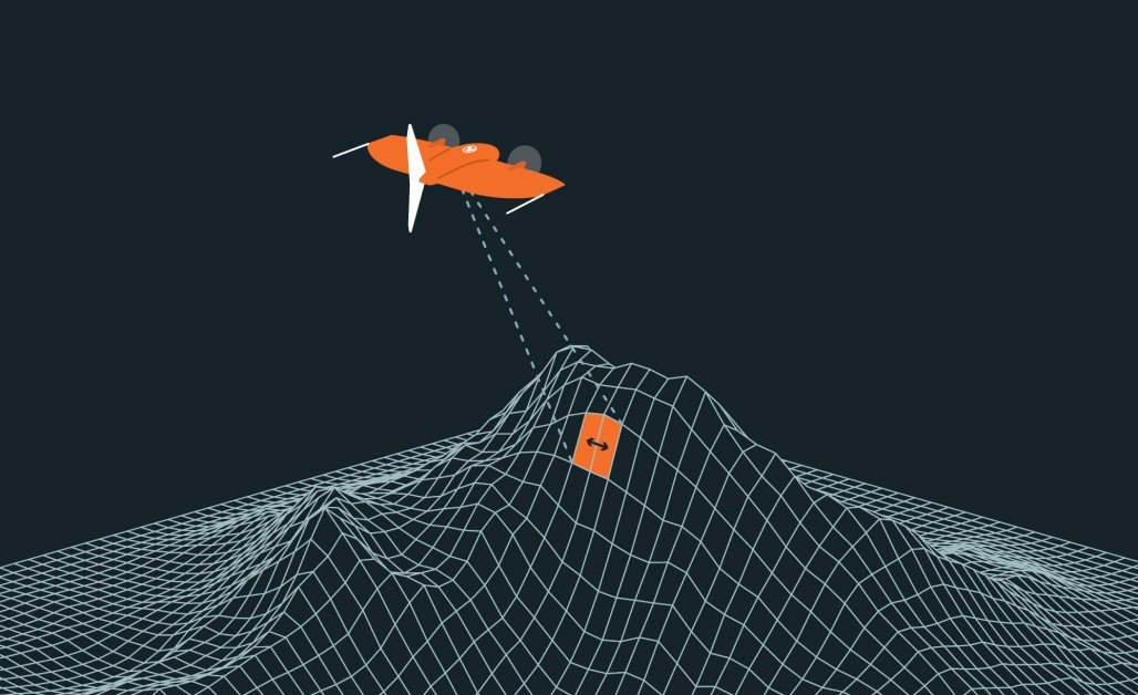
GSD (Ground Sampling Distance) is a measurement used in aerial imaging to describe the distance between two consecutive pixel centers on the ground, expressed in real-world units such as centimeters or inches. It represents the resolution of an image captured by a drone or other aerial platform. A smaller GSD value indicates higher image resolution, meaning more detailed and accurate images of the ground.
Usage
In drone operations, Ground Sampling Distance is a critical factor for applications like mapping, surveying, agriculture, and inspections. The Ground Sampling Distance value helps determine the level of detail in the imagery and the accuracy of measurements derived from it. For example, a Ground Sampling Distance of 2 cm means that each pixel in the image represents a 2 cm x 2 cm area on the ground.
Relevance to the Industry
GSD is essential for professionals in industries requiring precise spatial data. Surveyors, engineers, and agriculturalists rely on specific GSD values to ensure their data meets project requirements. Lower GSD values are crucial for tasks like identifying small features, measuring distances, or analyzing crop health, while higher GSD values may suffice for broader overviews.
How Does Ground Sampling Distance (GSD) Work?
Core Principles of GSD:
- Image Resolution and Pixel Size:
- Definition of GSD: Ground Sampling Distance (GSD) measures the size of one pixel on the ground as captured in an aerial image. For instance, a GSD of 2 cm means that one pixel in the image corresponds to a 2 cm x 2 cm area on the ground.
- Relationship to Image Resolution: Smaller GSD values (e.g., 1 cm) correspond to higher-resolution images with more detail, while larger GSD values (e.g., 10 cm) result in lower-resolution images, suitable for broader overviews.
- Influence of Camera and Drone Specifications:
- Sensor Pixel Size: Cameras with smaller pixel sizes on the sensor can capture higher-resolution images, resulting in lower GSD values.
- Focal Length: A longer focal length reduces GSD by magnifying the ground details, capturing more precise imagery.
- Flight Altitude: The higher the drone flies, the larger the GSD becomes, as each pixel represents a larger ground area. Lower altitudes reduce GSD, improving image resolution.
Calculation of GSD:
- The Formula for GSD:
- GSD Formula: GSD=Sensor Height (H) × Pixel SizeFocal Length (F)\text{GSD} = \frac{\text{Sensor Height (H) × Pixel Size}}{\text{Focal Length (F)}}GSD=Focal Length (F)Sensor Height (H) × Pixel Size
- Sensor Height (H): The drone’s altitude above ground level during image capture.
- Pixel Size: The size of each pixel on the camera sensor, typically measured in micrometers.
- Focal Length (F): The distance between the camera lens and the sensor, determining the field of view.
- GSD Formula: GSD=Sensor Height (H) × Pixel SizeFocal Length (F)\text{GSD} = \frac{\text{Sensor Height (H) × Pixel Size}}{\text{Focal Length (F)}}GSD=Focal Length (F)Sensor Height (H) × Pixel Size
- Practical Example:
- If a drone is flying at an altitude of 100 meters with a camera that has a pixel size of 2.4 µm and a focal length of 24 mm: GSD=100 m×2.4 μm24 mm=1 cm\text{GSD} = \frac{100 \, \text{m} × 2.4 \, \mu m}{24 \, \text{mm}} = 1 \, \text{cm}GSD=24mm100m×2.4μm=1cm This means each pixel represents a 1 cm x 1 cm area on the ground.
Applications and Importance of GSD:
- Mapping and Surveying:
- High-Resolution Mapping: Low Ground Sampling Distance values are critical for creating detailed orthomosaic maps and 3D models in industries like construction and land surveying. Precise Ground Sampling Distance ensures accurate distance and area measurements.
- Feature Detection: Small features, such as cracks in infrastructure or specific plants in agricultural fields, can only be detected at lower Ground Sampling Distance values.
- Agriculture and Environmental Monitoring:
- Crop Health Analysis: Drones equipped with cameras achieving low Ground Sampling Distance values can capture fine details of crop health, such as leaf discoloration or pest infestations.
- Land Use Monitoring: Higher Ground Sampling Distance values may suffice for monitoring larger-scale changes, such as forest coverage or urban sprawl.
- Inspection and Engineering:
- Infrastructure Inspections: Drones with low Ground Sampling Distance can identify micro-defects in structures like bridges, pipelines, and power lines.
- 3D Modeling: Accurate Ground Sampling Distance is vital for photogrammetry, where images are used to construct precise 3D models of terrain and structures.
Factors Affecting GSD During Operations:
- Altitude Variation:
- Higher Altitude, Larger GSD: As the drone increases in altitude, each pixel covers a larger ground area, reducing the resolution of the captured image.
- Optimal Altitude Selection: Operators must balance altitude with coverage area, ensuring the GSD meets project requirements while maximizing efficiency.
- Camera Calibration:
- High-Quality Lenses and Sensors: Using cameras with well-calibrated sensors and high-quality optics reduces distortion, ensuring accurate Ground Sampling Distance calculations.
- Lens Selection: Wide-angle lenses increase coverage but may increase Ground Sampling Distance, while telephoto lenses reduce Ground Sampling Distance for higher-resolution imaging.
Optimizing GSD for Specific Projects:
- Customizing for Project Needs:
- Detailed Inspections: For tasks requiring high detail, such as identifying small cracks, operators select lower altitudes and high-resolution cameras to achieve the smallest possible Ground Sampling Distance.
- Broad Surveys: For projects covering large areas, such as agricultural field surveys or wildlife monitoring, a higher Ground Sampling Distance may be acceptable to increase coverage efficiency.
- Data Post-Processing:
- Accuracy Enhancement: Ground Sampling Distance affects the precision of georeferenced data and 3D models. Software like Pix4D or DroneDeploy uses Ground Sampling Distance to create detailed, accurate maps and models.
- Quality Assessment: Operators review Ground Sampling Distance values during post-processing to ensure the final data meets project specifications.
By calculating and optimizing Ground Sampling Distance based on camera specifications, flight altitude, and project requirements, drone operators ensure their aerial imagery is tailored to meet the resolution and accuracy needs of diverse applications in mapping, surveying, agriculture, and inspections.
Example in Use
“The drone’s camera achieved a GSD of 1.5 cm, providing highly detailed images suitable for creating accurate topographic maps of the construction site.”
Frequently Asked Questions about GSD (Ground Sampling Distance)
1. How is GSD calculated?
Answer: Ground Sampling Distance is calculated using the formula:
GSD=Sensor Height (H) × Pixel SizeFocal Length (F)\text{GSD} = \frac{\text{Sensor Height (H) × Pixel Size}}{\text{Focal Length (F)}}GSD=Focal Length (F)Sensor Height (H) × Pixel Size
Where:
- Sensor Height (H): The altitude of the drone above ground level.
- Pixel Size: The physical size of a pixel on the camera sensor.
- Focal Length (F): The focal length of the camera lens.
2. Why is GSD important in aerial mapping?
Answer: Ground Sampling Distance determines the resolution and detail of aerial imagery, which impacts:
- Data Accuracy: Ensuring precise measurements for mapping and surveying.
- Feature Visibility: Identifying small objects or details in the imagery.
- Project Requirements: Meeting the resolution standards needed for specific applications.
3. What factors influence GSD?
Answer: Ground Sampling Distance is influenced by:
- Altitude: Increasing the drone’s flight height increases the Ground Sampling Distance (lower resolution).
- Camera Specifications: Larger sensors and smaller pixel sizes reduce Ground Sampling Distance (higher resolution).
- Lens Focal Length: Longer focal lengths can reduce Ground Sampling Distance, improving resolution.
For examples of these acronyms visit our Industries page.
As the CEO of Flyeye.io, Jacob Stoner spearheads the company's operations with his extensive expertise in the drone industry. He is a licensed commercial drone operator in Canada, where he frequently conducts drone inspections. Jacob is a highly respected figure within his local drone community, where he indulges his passion for videography during his leisure time. Above all, Jacob's keen interest lies in the potential societal impact of drone technology advancements.


