Drone Regulations
Airspace Chart Questions Explained

Airspace chart questions are among the most difficult problems on drone pilot exams. Whether you’re studying for the FAA Remote Pilot Certificate or Canada’s Advanced RPAS exam, understanding how to read aeronautical charts is essential.
Many pilots struggle not because the rules are complicated, but because the chart symbols, colors, and altitude markings are unfamiliar. Once you understand what the chart is actually showing, these questions become much easier to solve.
This guide breaks down how airspace charts work and the mistakes pilots commonly make when interpreting them.
What Airspace Charts Actually Show
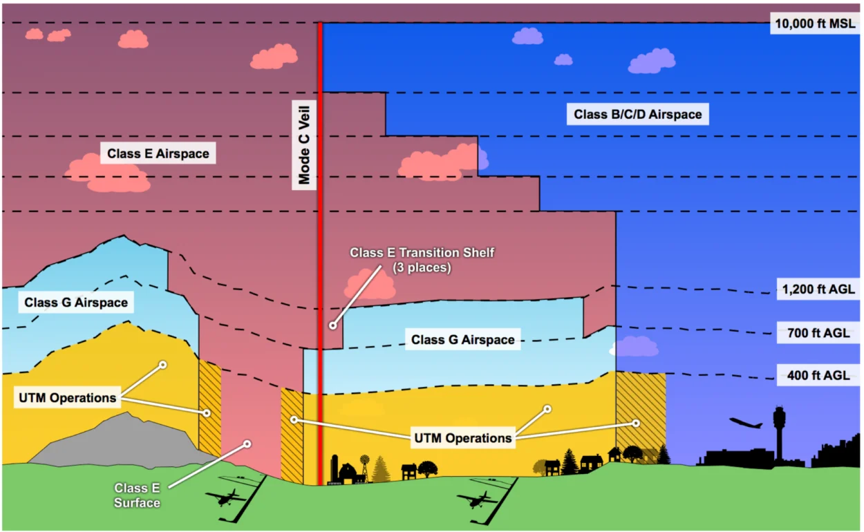
Aeronautical charts are visual maps of controlled airspace, airports, terrain, and navigation infrastructure. They allow pilots to quickly understand where aircraft operations are restricted or require authorization.
For drone pilots, charts primarily help determine:
• Controlled airspace boundaries
• Airport proximity
• Altitude restrictions
• Special use airspace
• Obstacle hazards

Both the FAA and Transport Canada use chart systems that follow similar aviation conventions, which is why understanding these maps is a core requirement for pilot certification.
Why Airspace Chart Questions Appear on Exams
Regulators test chart interpretation because safe drone operations depend on understanding airspace structure.
A drone pilot who cannot read an aeronautical chart may unintentionally enter controlled airspace or interfere with other aircraft.
For this reason, chart-reading questions appear frequently on both U.S. and Canadian licensing exams.
Common Airspace Chart Mistakes Pilots Make
Many exam mistakes happen because pilots misinterpret chart symbology.
One common error involves confusing Class B, C, D, and E airspace boundaries. The chart colors and dashed lines represent different types of controlled airspace, but they can look similar at first glance.
Another frequent mistake involves altitude markings. Pilots often misunderstand the numbers displayed inside sectional chart airspace rings, which indicate the vertical boundaries of controlled airspace.
Finally, some students forget that charts are designed for crewed aviation first. Drone rules are layered on top of the airspace structure shown on the map.
Understanding that distinction helps clarify many exam questions.
How to Interpret Altitude Markings
Many airspace chart questions test your ability to read altitude layers.
For example, a marking like 70 / SFC indicates that controlled airspace begins at the surface and extends upward to 7,000 feet.
Other markings may show a floor beginning above the ground, meaning certain lower altitudes remain uncontrolled.
These vertical layers determine when drone pilots must obtain authorization before flying.
Why Airspace Charts Use Colors and Rings
Airspace charts rely heavily on color coding and circular boundaries around airports.
Different colors indicate different classes of controlled airspace. The rings surrounding airports represent the vertical and lateral limits of that airspace.

These visual cues help pilots quickly identify where additional permissions may be required.
For drone pilots operating near airports, understanding these chart features is critical for compliance.
Practical Tip for Exam Questions
When answering chart questions, focus on three key elements:
- The airport at the center of the chart
- The colored rings around the airport
- The altitude markings inside those rings
If you identify those elements first, the rest of the question usually becomes straightforward.
Many pilots rush into interpreting the chart without first identifying the type of airspace involved.
Slowing down and reading the chart step by step improves accuracy significantly.
Frequently Asked Airspace Chart Questions
Do drone pilots need to understand sectional charts?
Yes. Both FAA and Transport Canada exams include airspace chart questions.
Are chart colors the same in Canada and the U.S.?
They are similar but not identical, which is why pilots should study the charts used in their country.
Do charts show drone restrictions directly?
No. Charts display aviation airspace structure. Drone rules apply on top of that structure.
What is the most common exam mistake?
Misinterpreting altitude boundaries and controlled airspace rings.
Helpful Tools
• FlyEye Flight Check
• Drone Acronym Directory
• Canada RPAS Practice Exams
• FAA Part 107 Practice Exams
FlyEye Perspective
Airspace chart questions are not designed to trick pilots. They test whether you can safely interpret the structure of the airspace around you.
Once you understand what the chart symbols represent, these questions become far less intimidating.
For professional drone operators, chart interpretation is not just an exam skill — it is a fundamental part of safe flight planning.